Riding Introduction
Historical Election Results in 2008
Voting Results | View Map of Results
Electoral District Profile
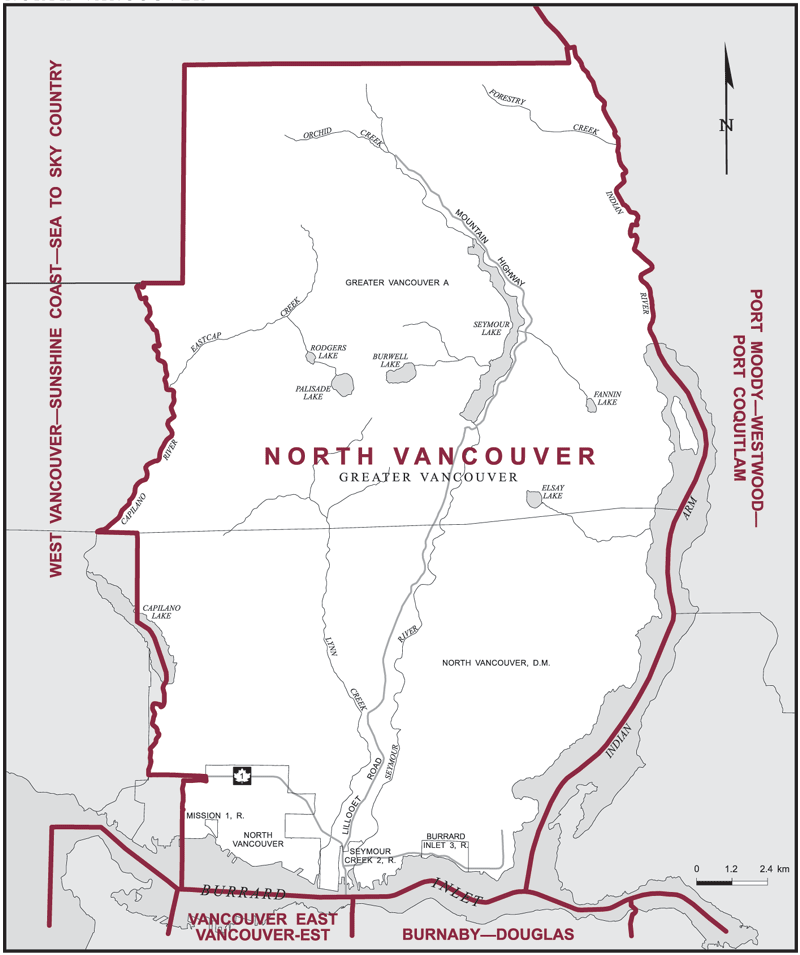
The electoral district of North Vancouver (British Columbia) covers an area of 433 km2, and has a population of 122,371 with 87,034 registered voters and 213 polling divisions.
The electoral district's boundaries are described as, consisting of those parts of the Greater Vancouver Regional District comprised of:
(a) that part of Subdivision A lying easterly of the Capilano River and westerly of Indian Arm and the Indian River;
(b) the District Municipality of North Vancouver, excepting that area lying southerly and westerly of a line described as follows: commencing at the intersection of the westerly limit of the City of North Vancouver with the Trans-Canada Highway (Highway No. 1, Upper Levels Highway); thence westerly along said highway to the westerly limit of the District Municipality of North Vancouver in the Capilano River; thence generally northerly along said limit, said river and Capilano Lake to the westerly limit of said district;
(c) the City of North Vancouver; and
(d) Mission Indian Reserve No. 1, Seymour Creek Indian Reserve No. 2 and Burrard Inlet Indian Reserve No. 3.
Downloads
- Boundary Map (gif | pdf)
- Poll-by-Poll Results Raw Data (csv)
- Statistics (Statistics Canada | BC Stats)