Riding Introduction
Historical Election Results in 2008
Voting Results | View Map of Results
Electoral District Profile
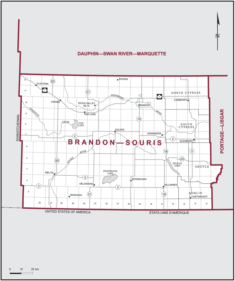
The electoral district of Brandon--Souris (Manitoba) covers an area of 19,836 km2, and has a population of 84,602 with 61,289 registered voters and 182 polling divisions.
Consisting of that part of the Province of Manitoba described as follows: commencing at the intersection of the west boundary of the Province of Manitoba with the north boundary of Tp 12; thence east along the north boundary of Tp 12 to the east boundary of R 13 W 1, being the easterly boundary of the Rural Municipality of North Cypress; thence generally southerly along the easterly limits of the rural municipalities of North Cypress, South Cypress, Argyle and Roblin to the south boundary of the Province of Manitoba; thence west and north along the south and west boundaries of said province to the point of commencement.
Downloads
- Boundary Map (gif | pdf)
- Poll-by-Poll Results Raw Data (csv)
- Statistics (Statistics Canada | BC Stats)