Riding Introduction
Historical Election Results in 2008
Voting Results | View Map of Results
Electoral District Profile
The electoral district of Victoria (British Columbia) covers an area of 43 km2, and has a population of 108,771 with 88,118 registered voters and 231 polling divisions.
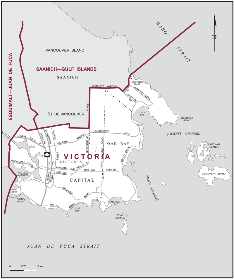
The electoral district's boundaries are described as, consisting of those parts of the Capital Regional District comprised of:
(a) the City of Victoria;
(b) the District Municipality of Oak Bay;
(c) that part of the District Municipality of Saanich lying easterly and southerly of a line described as follows: commencing at the intersection of the southerly limit of said district municipality with Shelbourne Street; thence northerly along said street to McKenzie Avenue; thence easterly along said avenue and southeasterly along Sinclair Road to Finnerty Road; thence northeasterly along Finnerty Road, Arbutus Road, Hollydene Place and its northeasterly production to the easterly limit of the Capital Regional District; and
(d) that part lying easterly of a line drawn due south from Ogden Point and south of a line drawn due east from Cadboro Point.
Downloads
- Boundary Map (gif | pdf)
- Poll-by-Poll Results Raw Data (csv)
- Statistics (Statistics Canada | BC Stats)