Riding Introduction
Historical Election Results in 2011
Voting Results | View Map of Results
Electoral District Profile
The electoral district of Toronto--Danforth (Ontario) covers an area of 26 km2, and has a population of 103,655 with 74,409 registered voters and 183 polling divisions.
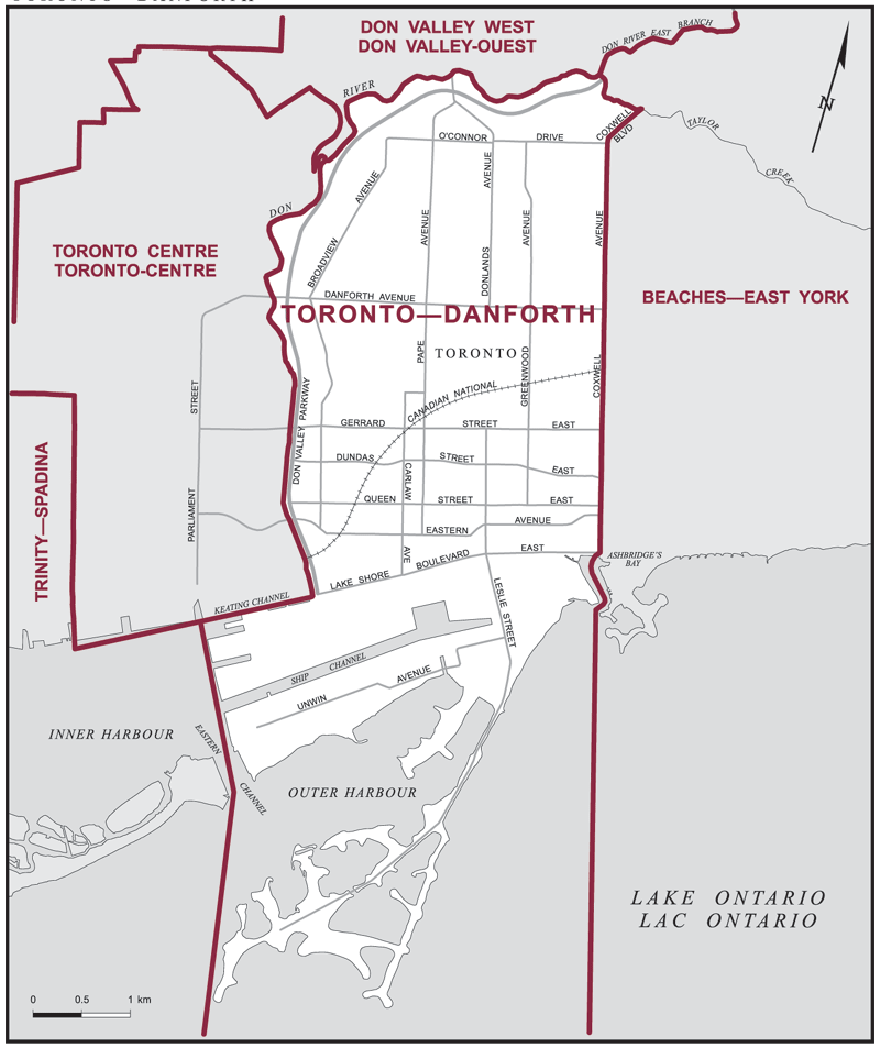
Consisting of that part of the City of Toronto described as follows: commencing at the intersection of the southerly limit of the City of Toronto with a line drawn due south from the southerly extremity of Ashbridge's Bay; thence due north along said line to the extremity of Ashbridge's Bay; thence generally northerly along said bay to its intersection with a straight line drawn on a bearing of 210° from the intersection of Coxwell Avenue and Lake Shore Boulevard East; thence in a straight line on a bearing of 30° to said intersection; thence northerly along Coxwell Avenue to Coxwell Boulevard; thence northeasterly along said boulevard and its production to Taylor Creek; thence generally westerly along said creek and the Don River East Branch to the Don River; thence generally westerly and generally southerly along said river to the Keating Channel; thence westerly along said channel and its production to the southerly production of Parliament Street; thence southerly to the southerly extremity of the Eastern Channel of Toronto Harbour; thence southerly to the corner of the southerly limit of the City of Toronto, said corner being situated southerly of the Outer Harbour East Headland (Leslie Street Spit); thence generally northeasterly along said limit to the point of commencement.
Downloads
- Boundary Map (gif | pdf)
- Poll-by-Poll Results Raw Data (csv)
- Statistics (Statistics Canada | BC Stats)