Riding Introduction
Historical Election Results in 2008
Voting Results | View Map of Results
Electoral District Profile
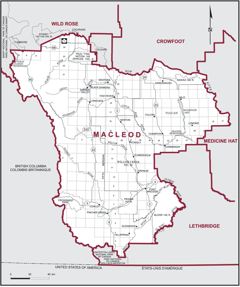
The electoral district of Macleod (Alberta) covers an area of 28,387 km2, and has a population of 107,638 with 85,720 registered voters and 180 polling divisions.
The electoral district's boundaries are described as, consisting of that part of the Province of Alberta described as follows: commencing at the intersection of the west boundary of said province with the northerly boundary of Waterton Lakes National Park of Canada; thence generally easterly along the northerly boundary of said park to the Belly River; thence generally northerly along said river to the southerly boundary of Blood Indian Reserve No. 148; thence easterly, generally northeasterly and generally northwesterly along the southerly and easterly boundaries of said Indian reserve to the easterly limit of the Municipal District of Willow Creek No. 26; thence generally northwesterly along said limit to the southerly limit of Vulcan County; thence generally northeasterly along said limit to the right bank of the Bow River; thence generally northwesterly along said bank to the southeasterly corner of Siksika Indian Reserve No. 146; thence generally northerly, generally westerly and southerly along the easterly, northerly and westerly boundaries of said Indian reserve to the right bank of the Bow River; thence generally westerly along said bank to the easterly limit of the City of Calgary; thence generally westerly, northerly, easterly and generally northerly along the southerly and westerly limits of said city to the left bank of the Bow River; thence generally northwesterly along said bank to the easterly boundary of the Town of Cochrane; thence generally southerly, westerly and generally northwesterly along the easterly and southerly limits of said town to the southeasterly corner of Stoney Indian Reserve No. 142-143-144; thence generally westerly and southwesterly along the southerly boundary of said Indian reserve to the west boundary of R 7 W 5; thence south along the west boundary of R 7 W 5 to the north boundary of Tp 23; thence west along the north boundary of Tp 23 to the southerly limit of the Town of Canmore; thence west, south, west, north and west along said limit to the north boundary of Tp 23; thence west along the north boundary of Tp 23 to the easterly boundary of Banff National Park of Canada; thence generally southerly along said boundary to the west boundary of said province; thence generally southeasterly along said boundary to the point of commencement.
Downloads
- Boundary Map (gif | pdf)
- Poll-by-Poll Results Raw Data (csv)
- Statistics (Statistics Canada | BC Stats)