Riding Introduction
Historical Election Results in 2008
Voting Results | View Map of Results
Electoral District Profile
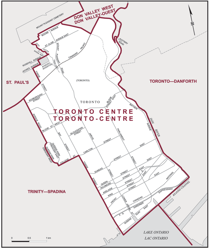
The electoral district of Toronto Centre (Ontario) covers an area of 14 km2, and has a population of 121,407 with 88,810 registered voters and 248 polling divisions.
Consisting of that part of the City of Toronto described as follows: commencing at the intersection of Avenue Road with the Canadian Pacific Railway; thence easterly along said railway to Yonge Street; thence northerly along said street to Jackes Avenue; thence easterly along said avenue to the westerly limit of the Rosehill Reservoir; thence northerly along said limit to Rosehill Avenue; thence easterly along said avenue and its production to the Don River Tributary situated easterly of Avoca Avenue; thence generally northwesterly along said tributary to the southerly limit of the Mount Pleasant Cemetery; thence generally easterly along said limit to the former easterly limit of the City of Toronto, at the intersection of Bayview Avenue with Moore Avenue; thence southeasterly along said former limit to the Canadian Pacific Railway; thence northeasterly along said railway to Bayview Avenue; thence generally southerly along said avenue to Pottery Road; thence generally northeasterly along said road to the Don River; thence generally southerly along said river to Keating Channel; thence southwesterly along said channel and its production to the southerly production of Yonge Street; thence northerly along said production and Yonge Street to College Street; thence westerly along College Street to Queens Park; thence northerly along Queens Park, Queens Park Crescent West, Queens Park and Avenue Road to the point of commencement.
Downloads
- Boundary Map (gif | pdf)
- Poll-by-Poll Results Raw Data (csv)
- Statistics (Statistics Canada | BC Stats)